
Unlock the power of Unify™, five years and $5M in the making!
Seamlessly process data from various collector systems and data sets, providing unparalleled flexibility.
Enjoy the freedom of customizable configurations and workflows, all presented through a simple, intuitive user interface.
Infinitely scalable, ensuring it grows with your needs.
Immersive visual reporting that enhances understanding like never before.
Overview
Consider Unify™ your “easy button” for seamless data collection, lightning-fast processing, and efficient publishing of results to clients and stakeholders. Unify™ is integrated into ICC collection vehicles and was designed to overcome common industry limitations. The software keeps all processing steps inside one piece of software, resulting in a consistent, automated, end-to-end workflow, ensuring that accurate and repeatable data is used to build planning and programming activities.
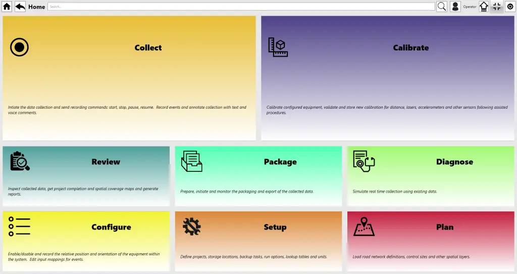
Drive™ simplifies data collection by providing real-time quality control, GIS maps, section tracking, exception tracking, and built-in calibration schedules, among other tools.
Connect™ automates the major steps of data processing, including matching collected data to the road network (GIS), distress identification, and reporting.
Inform™ provides web-based access to roadway data, right-of-way images, etc. just a few weeks after collection! It offers users an incredibly intuitive interface that is cloud-hosted, cost-effective, and requires no agency IT involvement.


Benefits
Universal Compatibility
Process data from various vendors' collector systems and datasets.
Customizable Configurations
Tailor workflows and settings to your specific needs.
Intuitive User Interface
Enjoy a user-friendly and straightforward interface.
Resource Optimization
Streamline operations, allowing more time for quality control.
Scalability
Infinitely scalable to meet evolving data management needs.
End-to-End Workflow
Proprietary suite includes Drive™, Connect™, and Inform™ for comprehensive data processing.
GIS Integration
Connect™ software seamlessly matches collected data to GIS for tracking exceptions.
Optimized Crack Detection
Customized settings based on pavement type and condition for superior results.
Cloud-Based Accessibility
Inform™ software provides easy web-based access to data and images with no IT involvement.
Customized Dashboards
Engage stakeholders with visually immersive reports in ArcGIS StoryMaps.
Read More


Inform™ Benefits
Arizona DOT and Inform: A Case Study in Partnership
About company

Contact Us
- 10630 75th Street Largo, FL 33777
- +1 727-547-0696 USA
- +1 289-807-4371 CAN
- sales@icc-ims.com
© 2024 International Cybernetics Company, LP (ICC)