Cloud hosted
Running on powerful and secure cloud servers, Inform is ready to host hundreds of thousands of miles (km) of data. With minimal need to engage agency IT departments in user setup, deployment, or updates, the software can be accessible to your users in a matter of days (provided we have processed your data!).
Browser-based
Inform is built on HTML5, adheres to the latest web development standards, and runs in all popular web browsers. It does not require any software installation and has no third-party component dependencies.
Fast image playback
Utilizing the latest web technologies, playback of images is fast and smooth. Jumping from one road to another happens in an instant.
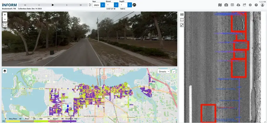
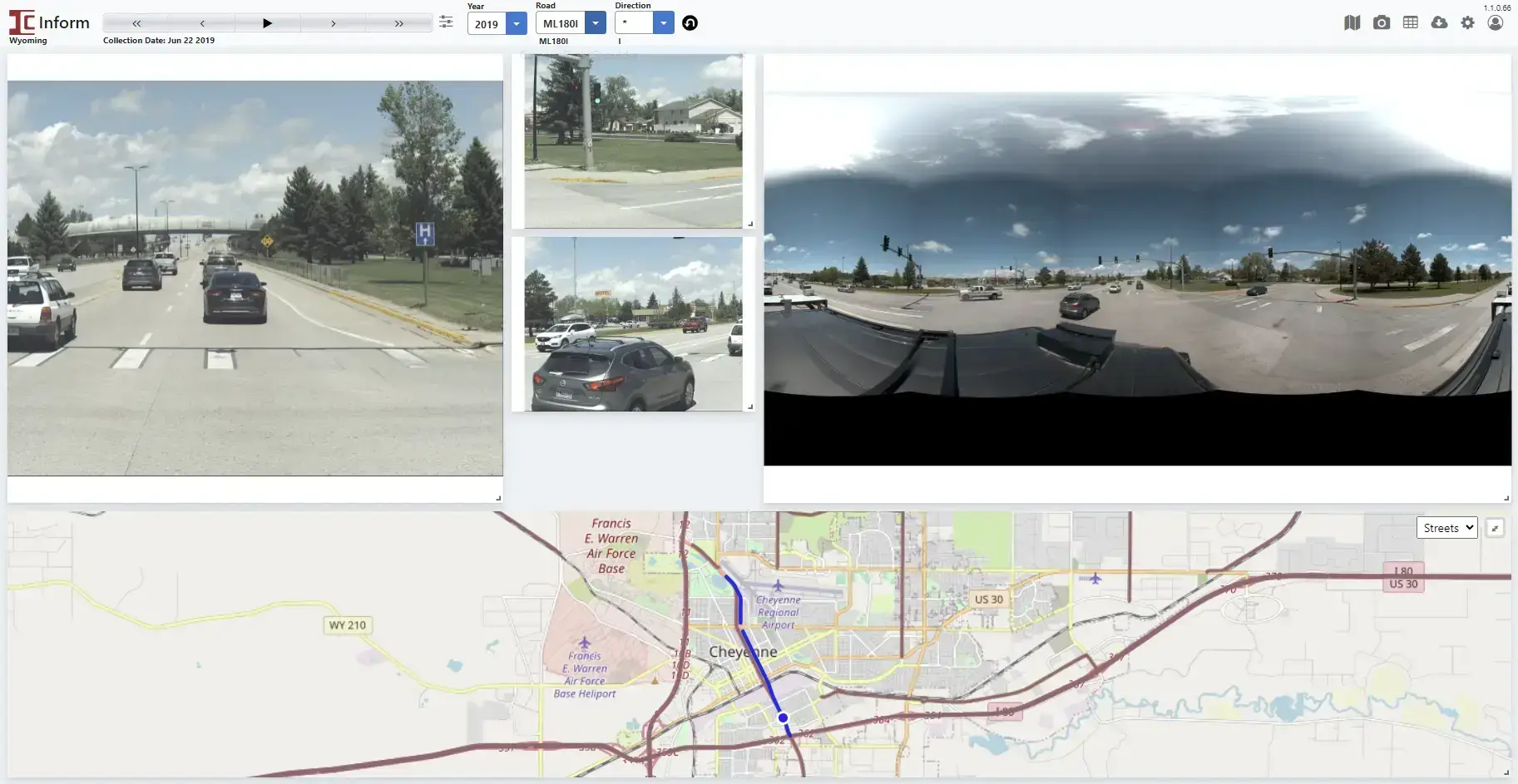
Point-and-click navigation
Users can click on any highlighted road on the map to jump to that location, or they can navigate using drop-downs by selecting District, County, Route, Direction, Milepost, Offset (typical for DOTs) or Council District, Neighborhood, Road Name (typical for municipalities and counties).
Easy user signup
We can automate sign-up for users with emails on your domain (e.g. azdot.gov, pinellas.gov). Optional SSO and MFA integrations are available as well.
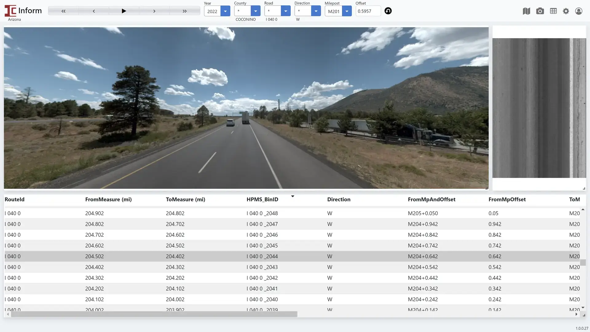
Browse reports
Inform™ includes tables and charts to display road condition data, HPMS reports, network attributes, and more. All processed and summarized data is at your fingertips.
360 view built-in
Pan-and-tilt the camera to look any way you want, and use the mouse wheel to zoom, right in your browser (provided the images have been collected with the Ladybug camera).
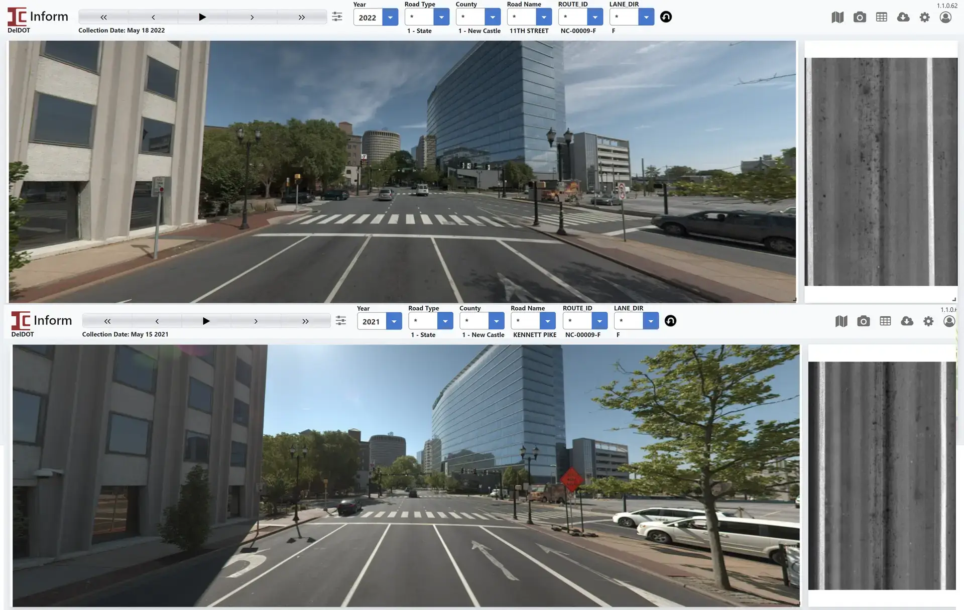
Go back in time
Easily access multiple cycles of historical images and data simply by clicking the Year dropdown.
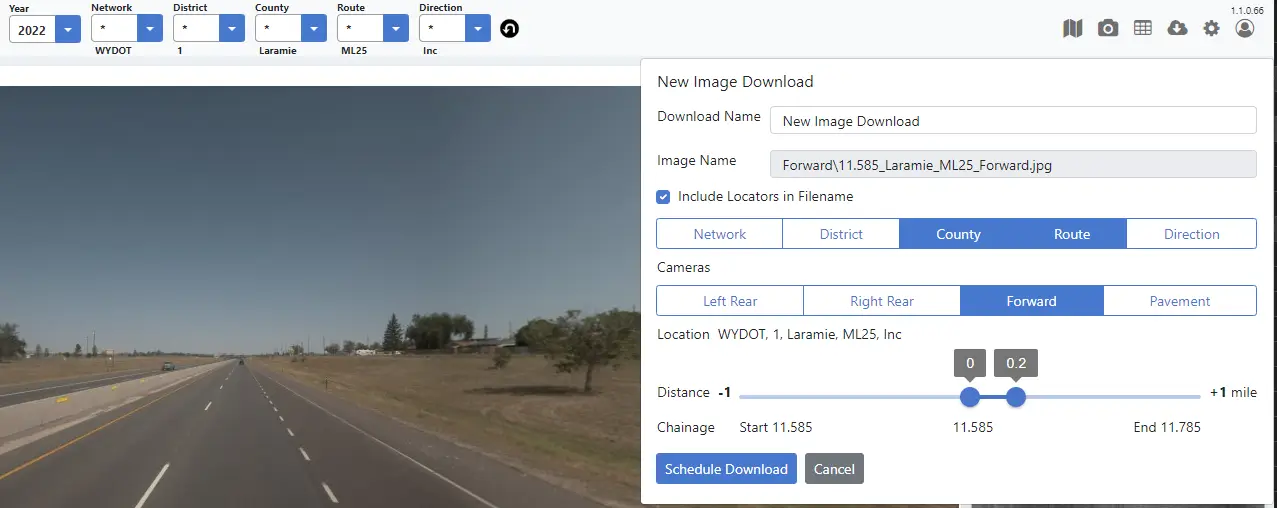
Images downloader
Easily send a batch of images to the legal department or to other external users with the built-in image downloader. Name the images how you want and choose the length of road to include.
Import images from any previous photolog
Unlock your historical photolog no matter who collected it. We can load your previous photolog into Inform™, whether it was collected by your agency or by another vendor.
Always Up-to-Date
More Features