
Dallas Fort Worth International Airport, Texas
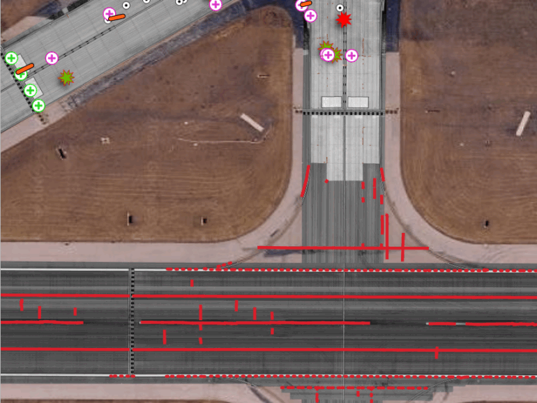
Dallas Fort Worth (DFW) International Airport—one of the world’s largest and busiest aviation hubs—partnered with IMS to complete a comprehensive pavement condition survey across its airfield and landside assets. Leveraging cutting-edge LCMS-2 technology, IMS captured ultra–high-resolution imagery at 1×2 millimeter precision, producing a georeferenced raster layer and detailed distress mapping for every sample unit in accordance with ASTM D5340 standards. This data-driven approach provided DFW with pavement insights of unparalleled accuracy and clarity, supporting both operational efficiency and long-term infrastructure planning.
IMS processed the survey data using over 13,200 anchor points to create a perfectly aligned, stitched pavement layer with no overlaps—seamlessly integrated with the airport’s existing section layers. Each area was analyzed for surface distresses and assigned a Pavement Condition Index (PCI) value, giving DFW a complete, objective picture of pavement performance across its vast network. A rigorous quality control program, including field inspections and cross-checks with prior datasets, ensured full data reliability and repeatability.
The result is a high-fidelity digital pavement record that empowers DFW to make informed, data-driven maintenance and investment decisions. By combining advanced imaging technology, precision georeferencing, and strict quality standards, our team delivered a pavement management foundation that meets the demands of one of the most complex and high-traffic transportation environments in the world.