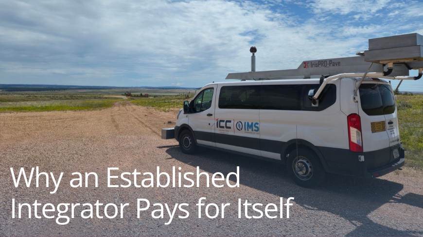
Why an Established Integrator Pays for Itself Buy a platform, not just a sensor. With an experienced LCMS-2 integrator you get: Proven architecture: field-tested mounting, trigger sync, power regulation, thermal…
Category: Software
 Software
The Value a Trusted Integrator Brings
By Jessica Kushner0Selecting an established LCMS-2 integrator means that sensor mounting, timing and trigger synchronization, power and thermal management, and high-throughput recording are already engineered and field-proven. This foundation shortens deployment and…
 SoftwareTeam
Learn about Pavement Management as a Service (PMaaS)
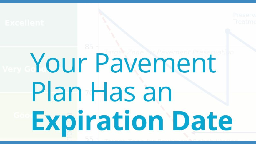
By Jessica Kushner0You paid for a pavement management plan and it’s sitting in a folder somewhere. Meanwhile: 🔧 A water main repair rerouted traffic on one of your collector roads 💰 A…
 Software
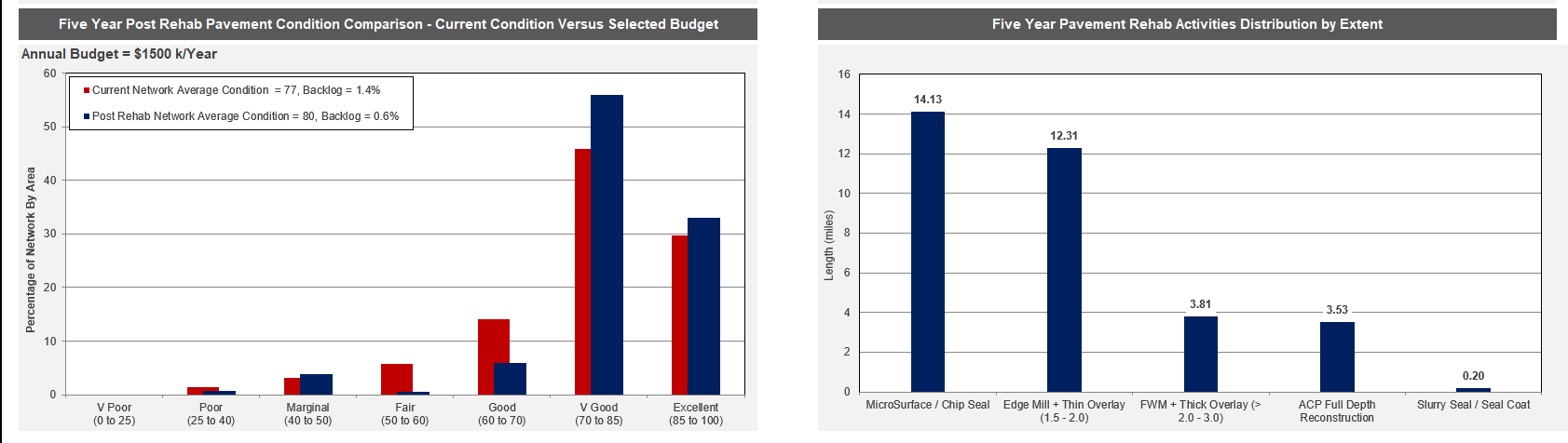
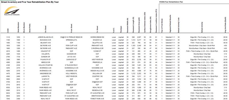
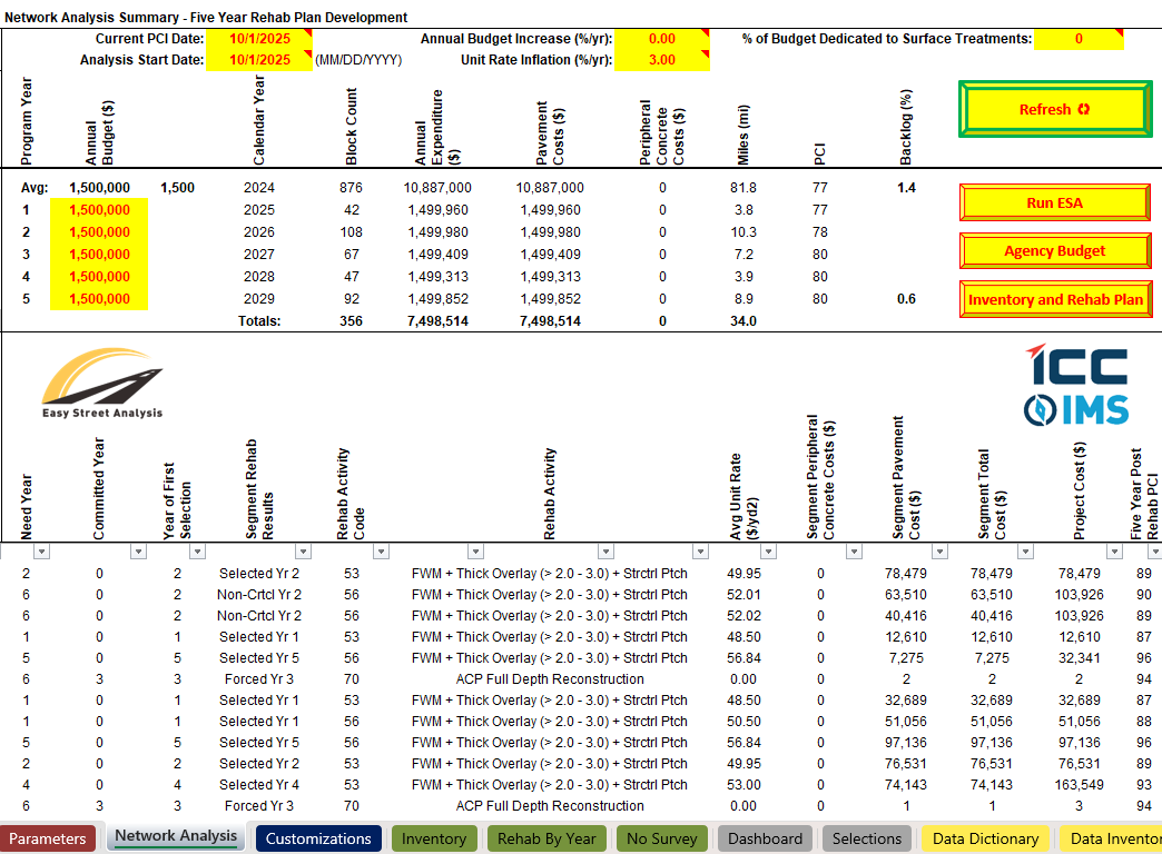
Maximize the Potential of Your Pavement Management System!
By Jessica Kushner0Your Pavement Management System (PMS) is a powerful tool that can help you keep your community informed, prioritize repairs, and allocate budgets efficiently. Easy Street Analysis (ESA™) takes it…
 IndustrySoftware
Drive™ 1.9.7 is here!
By admin0We are happy to announce the release of Drive™ 1.9.7, the latest update to our data collection software for the IrisPRO™ family of pavement condition vehicles. This release introduces a…
ICC-IMS' Easy Street Analysis (ESA™)
By admin0ICC-IMS’ Easy Street Analysis (ESA™) combines the core analysis capabilities of advanced pavement management systems with the ease and flexibility of a Microsoft® Excel environment. ESA™ provides agencies with actionable…